Seawall repair in Cocoa Beach
Start with the water beside your property. A sheltered canal, an open Banana River shoreline and an Atlantic-facing site raise different repair and permitting questions.
Describe your project on this page ↓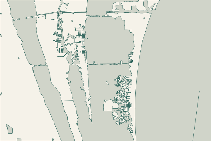
Get to know your waterfront
For lagoon-side properties, investigate the wall together with the yard drainage, dock and neighboring shoreline. Cocoa Beach's own projects show why: McNabb Parkway combines seawall work with a bioswale, while the Convair Cove design pairs runoff treatment with a living shoreline. Oceanfront work needs a separate conversation about beaches, dunes and the Coastal Construction Control Line. These are distinct conditions within one city, not interchangeable seawall designs.
Bids.Aspx · Convair Cove Low Impact Development Lid And Living Shoreline · Coastal Construction Control Line
Follow the water before choosing a repair
Start with your side of the island
Sheltered canal
Gather the existing wall and dock records. Include narrow access, drains and adjoining structures in the assessment.
Open Banana River
Ask how exposure, water levels and neighboring transitions affect the proposal.
Atlantic beach
Start with beach, dune and coastal review. Use the oceanfront planning guide.
Convair Cove Low Impact Development Lid And Living Shoreline · Coastal Construction Control Line
Photograph the same wall sections after rain and during ordinary conditions. Include the cap, exposed face, yard depressions, drain outlets and dock connections. Note when soil loss or standing water appears. Ask the assessor to explain which observations suggest a structural problem, drainage problem or both; a filled depression alone does not establish that the cause has been corrected.
Convair Cove and the central lagoon
DEP's Convair Cove record describes permeable paving, rain tanks, treatment media and planted bioswales alongside a living shoreline. Use that local example to ask where roof and yard runoff goes before it reaches your wall. It is evidence of a combined approach, not a design prescription for every lot. Convair Cove Low Impact Development Lid And Living Shoreline
Thousand Islands and the southern waterfront
For properties looking toward the Thousand Islands, draw the proposed water access and staging route. The county identifies Ramp Road as a boat-access point for the conservation area; most island access is by boat. A recreational launch or neighboring conservation island is not automatically an authorized construction base. Resolve permission, loading and material storage before accepting an access allowance. 2025 Thousand Island Conservation Area Trail Map.Pdf Legislationdetail.Aspx
For a South Cocoa Beach mailing address, first confirm the parcel's permitting jurisdiction. Then distinguish sheltered canal frontage from a more exposed water edge. Give the designer actual site photographs and a survey rather than relying on the neighborhood name.
Public drains and private walls
Report obstructed city canals or persistent street-drain problems to Stormwater at 321-868-3292. Ask separately who owns any outlet beside your wall. The McNabb public project does not establish responsibility for your parcel, and its awarded bid status does not prove that a particular nearby structure has been completed. Faq Faq Bids.Aspx
Atlantic frontage needs coastal review
Bring beach-side excavation, access and vegetation changes into the initial scope. DEP's CCCL program addresses beach and dune impacts, while Cocoa Beach also lists a dune trimming and restoration resource. A lagoon-wall estimate cannot settle those oceanfront approvals. Coastal Construction Control Line Permits
What could the work cost?
Ask for separate prices for investigation, engineering, wall work, drainage, dock conflicts, access and yard restoration. Identify any assumed barge route and who pays if it cannot be used. City permit fees depend on scope and project value; obtain a current calculation. Neither municipal project quantities nor a generic per-foot rate reliably prices your property.
Published contractor estimates for early planning. Each price keeps its original area and scope; your written quote confirms the full cost.
Compare quotes and plan a budget →Find the relevant permits and records
| Starting point | What to resolve | Prepare and look up |
|---|---|---|
Cocoa Beach Development Services | City building, site-plan and inspection questions; applications through OpenGov. | Address, survey, photographs and full scope. Call 321-868-3217; portal help: 321-868-3298. |
Cocoa Beach Stormwater | Street drainage and obstructions affecting clear passage in city canals. | Exact location and dated photos. Call 321-868-3292; distinguish public assets from your wall. |
DEP Coastal Construction Control Line program | Beach and dune activity where CCCL requirements apply. | Survey, construction limits and vegetation impacts. Call 850-245-8570 for coastal permitting guidance. |
Build a useful file before requesting prices
Give each bidder the same evidence so you can compare what the proposals actually cover.
Identify the parcel and shoreline
Record the address, parcel number, waterbody, survey date and visible wall problems. Confirm the correct local permit office.
Ldc Chapter Iv Article Ii Building Permit Application Procedures
Draw the access and drainage routes
Mark gates, dock structures, outlets, staging space and any proposed use of public or neighboring land.
Convair Cove Low Impact Development Lid And Living Shoreline · 2025 Thousand Island Conservation Area Trail Map.Pdf
Ask about the complete marine scope
Discuss wall alignment, fill, vegetation and dock changes together. Confirm which environmental or coastal approvals apply before mobilization.
Plan the closeout records
Ask which inspections apply and who supplies final approval and any required engineer certification. Keep them with your property documents.
Ldc Chapter Iv Article Ii Building Permit Application Procedures
Prepare your Cocoa Beach seawall project
Describe the location, visible damage, drainage concerns and access limitations you want an assessor to investigate.
Help understanding the problem, comparing options and planning the right repair.
Cocoa Beach project questions
Can I treat a canal repair as automatically exempt?
No. Florida's artificial-waterway exception has conditions involving water quality, navigation and flood control, with specific restrictions for lagoons. Establish whether the actual canal and proposed work qualify; the address alone does not answer that question.
Does replacing an existing wall avoid oceanfront permits?
Not necessarily. The statutory restoration exception expressly preserves Chapter 161 coastal permitting. For an Atlantic-facing site, discuss the wall, excavation, dune impacts and construction access with DEP as well as the local permit office.
Does the city's seawall program include my property?
The McNabb record concerns a named public project. Ask the city for the ownership boundary and location-specific plans before assuming any adjoining wall, outlet or restoration work is included. Public project information is useful context, not confirmation of private coverage.
Keep planning
Nearby waterfront guides
Show sourcesHide sources
- Bids.AspxSource reviewed 2026-10-25
- Convair Cove Low Impact Development Lid And Living ShorelineSource reviewed 2026-10-25
- Coastal Construction Control LineSource reviewed 2026-10-25
- 2025 Thousand Island Conservation Area Trail Map.PdfSource reviewed 2026-10-25
- Legislationdetail.AspxSource reviewed 2026-10-25
- FaqSource reviewed 2026-10-25
- PermitsSource reviewed 2026-10-25
- Development ServicesSource reviewed 2026-10-25
- Ldc Chapter Iv Article Ii Building Permit Application ProceduresSource reviewed 2026-10-25
- 403.813Source reviewed 2026-10-25
- FaqSource reviewed 2026-10-25