Merritt Island seawall repair and shoreline planning
Identify your shoreline before choosing a repair: a residential canal, Newfound Harbor and an open riverfront property can lead to different designs and permit questions.
Describe your project on this page ↓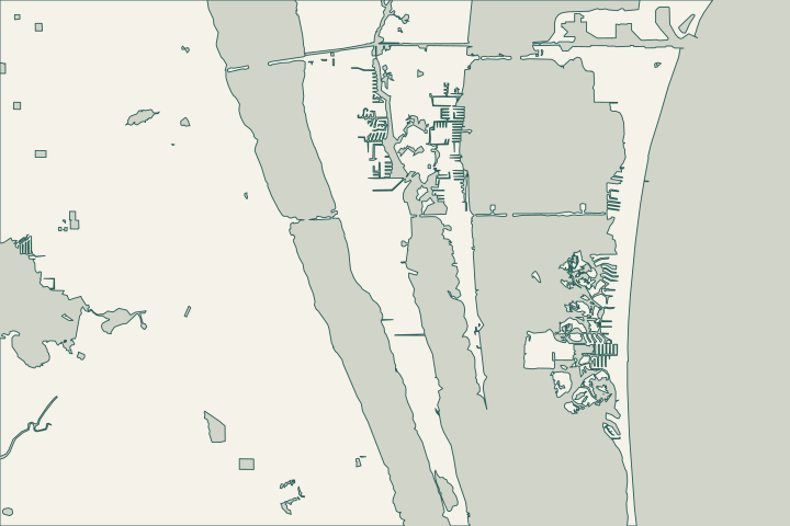
Get to know your waterfront
Merritt Island includes several waterfront settings. Banana River Aquatic Preserve takes in Newfound Harbor and Sykes Creek. Along South Tropical Trail, county records even describe parcels reaching from Indian River to Banana River. Treat each waterfront edge separately: vegetation, structures, drainage and neighboring walls may differ.
DEP Banana River Aquatic Preserve · Brevard Board of Adjustment March 24, 2021 minutes
Which waterfront are you planning around?
Residential canals: document the existing wall
Begin with the permitted alignment, visible condition and adjoining structures. Brevard routes canal bulkheads through combined building and surface-water review. Certain restoration work can avoid a separate surface-water permit, but NRM still reviews stormwater. The exception has location, fill, ownership and functionality conditions. Brevard Code chapter 62, article X, surface water protection Brevard Code chapter 62, article X, surface water protection
Newfound Harbor: check vegetation and easements
A cleared access strip or new deck is not automatically part of the seawall job. A 2024 adopted county case on Newfound Harbor Drive addressed utility and drainage easements affecting an existing deck. Check your recorded plat and survey before choosing equipment access or permanent improvements. Brevard File 6996: Newfound Harbor easement vacation
Natural shoreline options deserve consideration. A 2020 county agenda proposed mangrove and spartina planting along approximately 100 feet on Newfound Harbor Drive. Completion is unverified. The useful question is whether suitable vegetation can be retained or incorporated into your design. SOIRL November 2020 agenda: Newfound Harbor Drive planting proposal
South Tropical Trail and the open river edges
On natural lagoon frontage, a replacement wall is not automatically an unrestricted like-for-like purchase. County code distinguishes these shores from residential canals and may require reinforced rock revetment habitat. Have NRM review the existing structure and alternatives before accepting a wall-only proposal. Brevard Code chapter 62, article X, surface water protection Brevard Code chapter 62, article X, surface water protection
Include the equipment route in the access plan for southern-island work. Brevard Road and Bridge administers Mathers Bridge. Confirm current conditions rather than relying on an old opening timetable. Brevard Road and Bridge Maintenance
Banana River: include water levels and runoff
SJRWMD describes lagoon movement as driven more by wind than tide. An ocean tide forecast cannot settle a property's wall elevation or drainage design. Ask which water levels, survey datum and runoff conditions informed the proposal. SJRWMD Indian River Lagoon fast facts
MIRA reported native shoreline buffer planting at Kelly Park East in April 2025. This local example can inform a discussion about vegetation and runoff; it does not show that the same treatment fits every lot. Merritt Island Redevelopment Agency: Kelly Park shoreline buffer planting
- Photograph cracks, leaning sections, settlement and wall transitions.
- Mark roof drains, yard low points and visible outlets on the survey.
- Separate structural repair, drainage, dock work and landscaping in the scope.
One property can have two shoreline questions
One edge has an older wall; the other has vegetation. Ask for a separate condition and shoreline classification for each frontage before treating them as one replacement project.
Brevard Code chapter 62, article X, surface water protection · Brevard Code chapter 62, article X, surface water protection · Brevard Board of Adjustment March 24, 2021 minutes
What could the work cost?
Compare quotes for the same measured work. Separate survey and design, permits, wall and cap work, anchors, drainage, access, disposal and restoration. Natural frontage with habitat work may involve a different scope from a canal repair of the same length.
Published contractor estimates for early planning. Each price keeps its original area and scope; your written quote confirms the full cost.
Compare quotes and plan a budget →Find the relevant permits and records
| Starting point | What to resolve | Prepare and look up |
|---|---|---|
Brevard County Building Permits | Residential marine work in manmade waterways. | Call (321) 633-2187 with the parcel, survey and proposed scope; ask which BASS application applies. |
Brevard Natural Resources Management | Shoreline, buffer, habitat and stormwater review. | Call (321) 633-2016. Show the alignment, vegetation and drainage; ask about the surface-water permit path. |
Florida DEP Central District | Applicable environmental and submerged-lands questions. | Call (407) 897-4100 with the full marine scope, including access and any mangrove impacts. |
Build a usable property file
Keep one annotated survey and one consistent scope for the designer, permitting offices and bidders.
Name the parcel and waterway
Record the tax account, address, water body and shoreline type. Do not infer jurisdiction from a mailing address.
About Brevard County · Brevard Code chapter 62, article X, surface water protection
Gather ownership and prior approvals
Find old marine permits, recorded easements and available as-built plans. The county affidavit makes ownership the applicant's responsibility.
Seawall and Dock Affidavit · Brevard File 6996: Newfound Harbor easement vacation
Agree on drainage and closeout
Identify who supplies the as-built survey and requests final inspection. Keep the approved stormwater layout with the maintenance records.
Prepare your Merritt Island assessment
Record the shoreline type, visible concern, available records and decisions you need an assessor to explain.
Help understanding the problem, comparing options and planning the right repair.
Merritt Island project questions
Does seawall repair need the same permit everywhere on the island?
The county distinguishes residential canals from natural lagoon shores. A limited restoration exception does not exempt an entire project. Describe the wall, drainage, fill and access together when asking Building Permits or NRM which approvals apply.
Brevard Code chapter 62, article X, surface water protection
Can mangroves be removed to reach a damaged wall?
Do not assume removal is allowed. DEP distinguishes trimming from alteration and recommends checking seawall-related mangrove work before starting. Send photographs and a marked plan so the access and shoreline work can be considered together.
Why inspect drainage when the visible problem is the wall?
Brevard requires stormwater review for shoreline work. Historic rainfall explains the practical concern: NWS reported 19.58 inches south-southeast of Merritt Island during Fay in August 2008. That station observation is context, not a property-specific design standard.
Brevard environmental permitting review process · NWS Melbourne Tropical Storm Fay summary
Keep planning
Nearby waterfront guides
Show sourcesHide sources
- DEP Banana River Aquatic PreserveSource reviewed 2026-10-25
- Brevard Board of Adjustment March 24, 2021 minutesSource reviewed 2026-10-25
- Brevard Code chapter 62, article X, surface water protectionSource reviewed 2026-10-25
- Brevard File 6996: Newfound Harbor easement vacationSource reviewed 2026-10-25
- SOIRL November 2020 agenda: Newfound Harbor Drive planting proposalSource reviewed 2026-10-25
- Brevard Road and Bridge MaintenanceSource reviewed 2026-10-25
- SJRWMD Indian River Lagoon fast factsSource reviewed 2026-10-25
- Merritt Island Redevelopment Agency: Kelly Park shoreline buffer plantingSource reviewed 2026-10-25
- Brevard County residential marine constructionSource reviewed 2026-10-25
- Brevard environmental permitting review processSource reviewed 2026-10-26
- Brevard Surface Water Permit ApplicationSource reviewed 2026-10-25
- DEP mangrove frequently asked questionsSource reviewed 2026-10-26
- DEP Central DistrictSource reviewed 2026-10-26
- About Brevard CountySource reviewed 2026-10-25
- Seawall and Dock AffidavitSource reviewed 2026-10-25
- NWS Melbourne Tropical Storm Fay summarySource reviewed 2026-10-25
- Brevard Kelly Park EastSource reviewed 2026-10-25